The Mushroom Navigator
The Mushroom Navigator (MN) is developed for Android and is a powerful tool for pickers to quickly and easily add location for new findings. The MN has an extensive database which includes some of the most popular mushrooms and wild berries. It can be used by the inexperienced as well as the experienced picker
This is the Mushroom Navigator
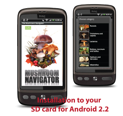
MN is a GPS navigator based program dedicated entirely for documenting findings of mushrooms and berries. Today, the database consists of our 12 most common wild berries and 75 of our most beloved mushrooms. Our intent is to expand this database if we see a public interest in other species. Starting with version 1.05 we also offer professional species information from Wikipedia. This information is very easy to access for each species.
The MN also gives you the option to add locations for species you have not yet been able to identify. You can identify them at a later stage and once you know which species it is, you can easily update the location to the correct one.
Adding new findings locations take very little time. Within 10 seconds a new location is added and you can spend more time on collecting. Since we are aware of that a typical user has many different applications installed we give you the option to install the application to your SD card if you have Android 2.2 or better.
Since we ourselves are very enthusiastic about collecting mushrooms and berries, the MN will be continuously improved and updated.
Extensive species information with Wikipedia
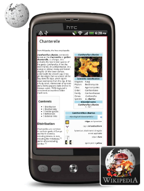
Wikipedia today offers extensive information on most of the species stored in the database and it is in constant development and improvement. We think that the descriptions are of such high quality that we now choose to integrate these with the MN.
You can quickly reach this information from the menu, where you are given the option to choose species from any of our categories or you can reach it through one of your added findings locations. We like this information to be quickly and easily accessible.
Presently, you will need an active Internet connection in order to access these pages. The reason is the extensiveness of this information and that we like to keep the size of this application to a minimum. Also, whenever Wikipedia pages are improved there is no need for an application update. Pages that have been viewed are stored in the cache memory and can be accessed even when the internet connectivity fails.
Compatible with Google Earth
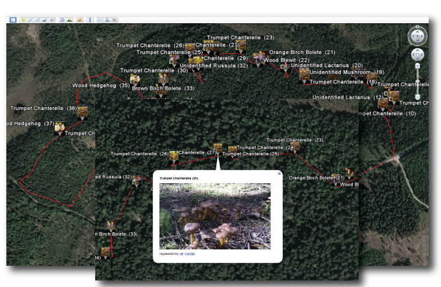
With MN you can export the database to Google Earth on your stationary computer in a few steps. With this function, your findings locations become a lot more accessible and you also secure them for the future. You can export directly to your SD-card or by email.
Every findings location is represented by a unique image icon, just as in the application. If you have made comments these will be visible to.
In the full version, your track will be visible as well as the pictures you have taken of your findings.
Upgrade to the full version
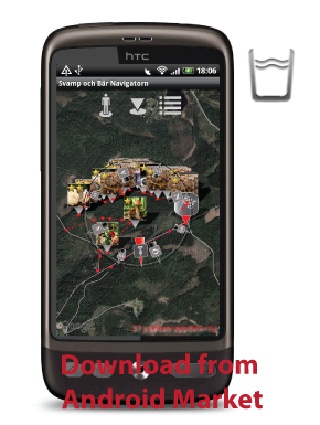
If you choose to upgrade to the full version of MN it becomes even more useful and competent. You can now store an unlimited number of locations. The free version limits added locations to 20.
Furthermore you have a function that automatically tracks and centers your location. To make it easier for you to find your way back home you can also set your starting location. You can find both the bearing and the distance to it.
Other new functions include:
+ Satellite maps are visible, giving you a better overview of the terrain
+ A built in compass showing your bearing as well as the distance and bearing to your start location and stored locations
+ Store and view your track
+ Lets you take pictures of your findings
+ Lets you export your track and pictures to Google Earth.
+ Much more.


